You’ve probably seen those viral photos.
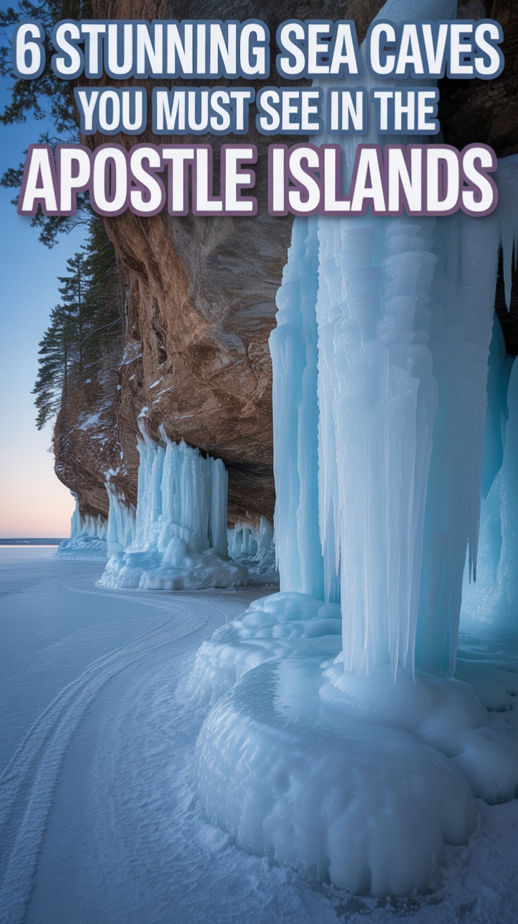
Towering ice formations jutting out from Lake Superior’s frozen shoreline.
Needle-like icicles hanging like crystalline chandeliers.
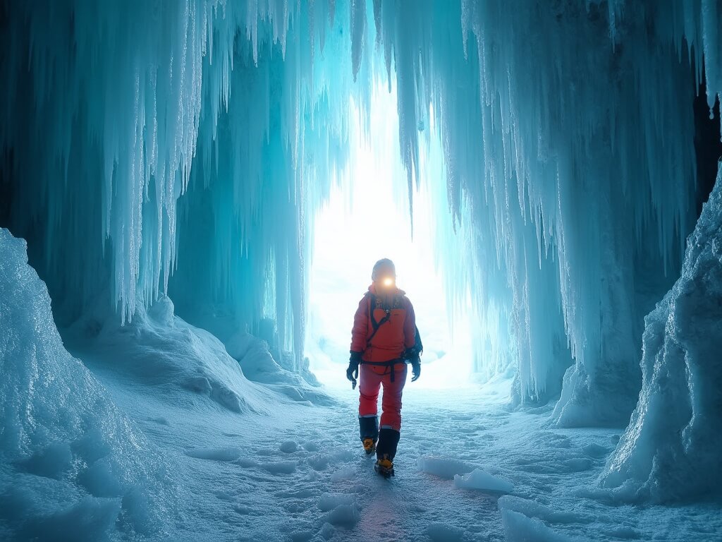
People actually walking inside caves carved entirely from frozen water.
It looks unreal—the kind of place that shouldn’t exist outside a fantasy film.
The truth is, it barely does.
The ice caves of Apostle Islands in Wisconsin are among the most elusive natural wonders you can chase in North America.
Most winters, they don’t open at all.
When they do, it’s for just a few weeks, sometimes days.
And when they’re finally accessible, thousands of people descend on Meyers Beach in northern Wisconsin hoping to witness something that won’t happen again for years.
I learned this the hard way during my first attempt.
I’d driven seven hours from Chicago in late January, armed with new ice cleats and genuine excitement.
The forecast promised sub-zero temperatures all week.
The conditions seemed perfect.
When I arrived at the ranger station near Bayfield, the answer was immediate and disappointing: the ice wasn’t thick enough yet, and wind patterns made it unstable.
Come back in three days, they said.
I didn’t.
But that experience taught me something crucial about visiting these caves—preparation and flexibility aren’t suggestions, they’re requirements.
Why the Apostle Islands Ice Caves Actually Matter (And Why They’re Vanishing)
The Apostle Islands National Lakeshore sits along Lake Superior, about 18 miles west of Bayfield, Wisconsin.
It’s home to dramatic sandstone cliffs, sea caves carved by millennia of waves and erosion, and during winter, something extraordinary happens.
Water seeps through cracks in the rock.
It freezes.
It builds up day after day, week after week, creating formations that look like something from another planet.
But here’s the thing nobody tells you: this only happens under very specific conditions.
The temperature needs to drop below freezing and stay there—we’re talking subzero cold—for weeks on end.
The winds across Lake Superior need to calm down.
The ice needs to form thick enough to safely support human weight.
And then, just as quickly as it appears, a single warm day or strong wind can destroy it all.
In 2014, the ice caves became an internet sensation.
Photos spread across social media.
News outlets covered the phenomenon.
Suddenly, everyone wanted to visit.
Thousands did.
It was the perfect storm of cold weather, stable ice, and viral timing.
Since then?
Only scattered years have offered significant access.
2015 had another good season.
After that, the openings became rarer and more unpredictable.
Climate change plays a role here—warmer winters mean fewer opportunities for the sustained subzero temperatures these formations need.
Lake Superior’s exposure to open water means the ice sheet is constantly under pressure, constantly breaking apart.
The window doesn’t just close.
It barely opens at all anymore.
The Geology Behind the Magic: How These Frozen Cathedrals Form
To understand why the ice caves are so rare, you need to understand what’s actually happening geologically.
The sea caves themselves are ancient.
Sandstone cliffs along Apostle Islands have been sculpted by waves, ice, and erosion for thousands of years.
These aren’t tunnels carved by water erosion—they’re the result of the rock’s weakness and Lake Superior’s relentless pounding.
Once the caves exist, winter transforms them.
Water from the lake, groundwater seeping through the cliffs, and spray from wave action all contribute to the ice buildup.
As temperatures drop, this water freezes in layers.
Icicles hang from the ceiling.
Frozen waterfalls form where water cascades down the rocks.
The cave floors become sheets of ice.
What makes it spectacular is how dynamic and temporary it all is.
Every single day brings changes.
A day of slightly warmer temperatures can melt the delicate formations.
A strong wind can break apart the ice shelf where you’d be walking.
A thaw followed by a refreeze creates different formations entirely.
Each winter’s ice caves are unique—truly one-of-a-kind sculptures that will never exist in exactly that form again.
That impermanence is part of what makes them so compelling.
You’re not visiting a permanent attraction.
You’re witnessing a temporary arrangement of conditions that might not happen again for years.
Key takeaway: The ice caves are a collision of geological history, weather patterns, and extreme timing—three things that rarely align perfectly anymore.
Why Most Winters You’ll Find the Caves Closed (Not Cancelled, Just Closed)
Here’s the honest truth about visiting the Apostle Islands ice caves in Wisconsin today.
You can’t just decide to go.
You can’t book a trip six months in advance with confidence.
You can’t guarantee your kids will see them.
Because most years, they simply won’t be accessible.
In the past decade, the number of winters with safe, publicly accessible ice caves can be counted on one hand.
Some years see no opening at all.
Others open for a week.
Rarely, you get a season like 2014 where conditions hold for several weeks.
The Park Service takes safety seriously—and rightfully so.
Walking on Lake Superior’s frozen surface isn’t inherently dangerous, but unstable ice absolutely is.
Thin ice can break unexpectedly.
Wind can create gaps between the ice and shore.
Rapid temperature swings can weaken structures that looked solid hours earlier.
The National Park Service monitors ice conditions daily during winter.
They test ice thickness.
They assess stability.
They watch weather patterns.
When conditions aren’t safe, they don’t open access.
When they do open, they publish updates through their official website and maintain a dedicated ice line phone number that gets updated regularly.
This isn’t bureaucratic caution—it’s necessary protection.
People have died slipping on ice or being caught by sudden weather changes in this region.
The Park Service isn’t preventing you from visiting; they’re preventing you from becoming a rescue statistic.
The reality: Your visit depends entirely on Lake Superior’s mood, not your schedule.
If you’re planning a trip, you need to be flexible.
You need a backup plan.
You need to understand that these caves might not open during your preferred travel window—or at all that winter.
Experienced visitors build trips around watching the conditions rather than booking firm dates.
They monitor the ice line.
They check forecasts.
They prepare to pivot if conditions look promising but not ideal.
Getting There: Where the Caves Actually Are (And How to Actually Reach Them)
The ice caves sit along the mainland shoreline of Apostle Islands, which is somewhat counterintuitive.
Most people think “Apostle Islands” and imagine island hopping.
The actual accessible ice caves are on the mainland.
Your primary access point is Meyers Beach, located near the small town of Cornucopia in northern Wisconsin’s Bayfield County.
From Milwaukee, it’s roughly a five-and-a-half-hour drive north.
From Chicago, expect seven to eight hours depending on traffic and weather.
From the Twin Cities, it’s about six hours.
The closest town with real services—hotels, restaurants, decent infrastructure—is Bayfield, which sits about 15 miles south.
Bayfield is worth knowing about because when ice cave season potentially opens (typically late January through February), accommodation fills up fast.
Hotels book weeks in advance.
Bed-and-breakfasts get reservations from people who’ve been monitoring the ice line for months.
If you’re serious about seeing the caves, you’ll need to plan your trip around condition updates rather than just showing up.
When the ice line indicates conditions are looking promising, you move.
Same-day or next-day trips happen constantly during potential opening windows.
Some visitors rent vacation homes in Bayfield or nearby towns specifically to be close enough to make the 30-minute drive to Meyers Beach when conditions improve.
The logistics breakdown:
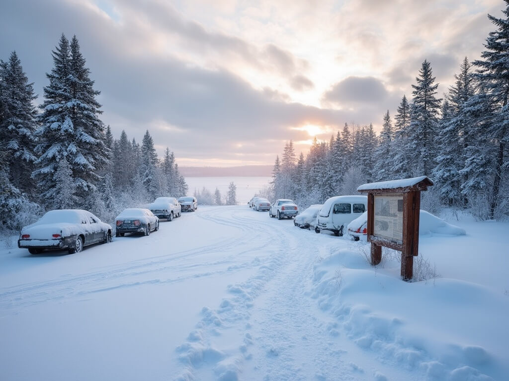
- Meyers Beach serves as the main trailhead and parking area
- Parking fees apply during ice season (typically $5-10 depending on vehicle size)
- The drive from Bayfield takes about 30 minutes
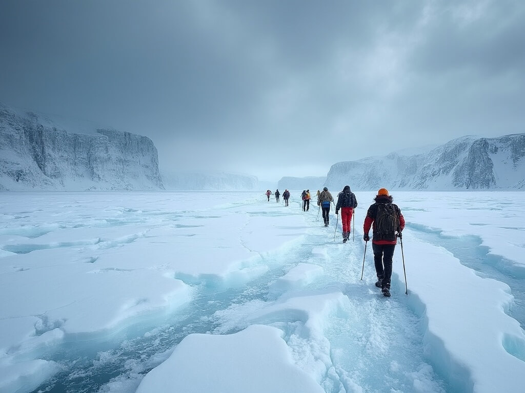
- The actual walk onto the ice typically spans one to four miles, depending on how far conditions allow
- Most of this walk happens on frozen Lake Superior, then transitions to walking inside or alongside the sea caves
That final point is crucial.
You’re literally walking on the frozen surface of one of the world’s largest freshwater lakes.
It’s surreal.
It’s also why the Park Service is so particular about ice thickness and stability.
What You Actually Need to Bring (And Yes, You’ll Probably Underprepare)
I made mistakes on my first attempt at the ice caves, and they taught me what actually matters.
Most people drastically underestimate the cold and the terrain.
Meyers Beach in late January or February isn’t just cold—it’s the kind of cold that bypasses your jacket and attacks your core.
Wind whips off Lake Superior with nothing to slow it down.
The ice isn’t flat or even.
It’s cracked, ridged, and unforgiving.
Here’s what you actually need:
- Waterproof boots with serious insulation (not hiking boots, actual insulated winter boots)
- Ice cleats or microspikes that fit securely over your boots (non-negotiable)
- Ski poles or trekking poles (they help you balance on uneven ice and catch yourself if you slip)
- Layered clothing (thermal base layer, insulating mid-layer, windproof jacket and pants)
- Insulated gloves (bring extras; wet gloves become useless quickly)
- Wool hat and face protection (balaclava or neck gaiter)
- Hand and foot warmers (not luxury, necessity)
- Backpack with water, snacks, and an emergency blanket
- Camera or phone (but expect battery drain in extreme cold)
- A headlamp if you’re going early or staying late (winter sun sets around 5 p.m.)
I learned the importance of ice cleats the hard way when someone without them lost footing 50 metres from shore and slid uncontrollably across the ice before stopping at a ridge.
They were fine, but the terror on their face told you everything about why Park Service rangers emphasise this equipment so heavily.
The terrain looks magical, but it’s genuinely hostile to unprepared visitors.
The psychological shift that matters: This isn’t a hike where you can tough it out. This is an environment where your body will shut down if you’re underprepared. Respect that.
The Drive North and What Wisconsin Winter Actually Feels Like
Before you arrive at Meyers Beach, you drive through some of the most remote terrain in Wisconsin.
The landscape gradually shifts.
Cities give way to small towns.
Small towns give way to forests.
Forests get denser and darker as you head toward Lake Superior.
Cell service becomes spotty.
The temperature drops noticeably as you approach the lakeshore.
You notice the wind first—it hits your car, pushes it slightly as you drive.
The trees along the roadside are often visibly bent, shaped by decades of prevailing winds.
You’ll pass through Bayfield, which has a charming downtown with local shops, restaurants, and galleries.
It’s worth stopping if you arrive with daylight remaining.
The town has genuine character—it’s a working community, not a touristy facade.
People here understand the lakes and seasons in ways southern Wisconsin residents don’t.
They know winter personally.
They know Lake Superior’s moods.
From Bayfield, the final drive to Meyers Beach takes you through increasingly remote landscape.
You’re moving away from civilisation.
The road becomes narrower.
The houses become more scattered.
Then you reach the parking area at Meyers Beach, and you see it.
Lake Superior, stretched out in front of you, frozen solid as far as you can see.
Or you see grey sky, grey ice, and grey water, depending on conditions.
But you’re standing at the edge of something genuinely wild.
That realisation hits differently when you’re actually there.
The photos don’t capture the scale or the sense of vulnerability that comes with standing on a frozen lake in subzero temperatures.
Looking for more cold-weather adventures? Check out our guide to taking a lighthouse tour in Maine or go west to walk the beaches of the Oregon Coast.
What You’ll Actually See When the Caves Open (And Why Photos Don’t Do It Justice)
There’s a reason those 2014 ice cave photos went viral.
They’re genuinely otherworldly.
But standing inside an actual ice cave is different from looking at a photograph of one.
The scale hits you first.
You’re not looking at a frozen waterfall the size of a person. You’re looking at formations twenty or thirty feet tall, sometimes higher. The cliffs above create natural chambers where ice has accumulated in layers so thick they’ve turned translucent.
Sunlight filtering through frozen water creates colours—blues and greens and whites—that your phone camera will completely fail to capture.
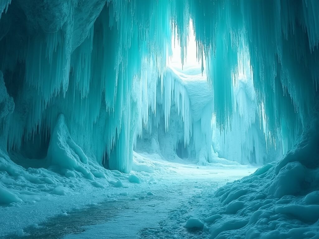
The texture is what strikes people most.
Ice doesn’t form smooth like glass. It forms with needle-like spikes pointing in random directions, creating surfaces that look simultaneously delicate and dangerous. You’ll see what locals call “ice curtains”—frozen waterfalls that cascade down cave walls, their surfaces rippled like actual fabric caught mid-motion.
Walk inside certain formations and the temperature drops noticeably. The cave itself becomes a kind of natural freezer, preserving ice that might melt outside. The floor isn’t solid ice but a collection of frozen ridges and smooth patches where water has repeatedly frozen in layers. Your ice cleats will grip where they grip and slide where they don’t, forcing you to move deliberately and carefully.
The most stunning formations:
- Arches of ice carved by water flow, perfectly shaped by natural forces
- Frozen waterfalls where groundwater continues leaking from the cliff and refreezing mid-cascade
- “Ice floors” in certain caves where you can see through partially transparent ice to the dark water below
- Icicle forests hanging from cave ceilings, some as thin as sewing needles, others thick as tree branches
- Natural alcoves where ice has built up symmetrically on both sides, creating geometric chambers
Most people spend three to five hours exploring once they’re on the ice. Some stay longer. The experience becomes meditative—the isolation, the cold, the strange beauty of a landscape that shouldn’t exist but does, at least for this moment.
The reality check: Those viral photos are real, but they’re also taken during peak conditions with good lighting. Most visits happen in overcast weather with grey skies. The caves are still stunning, just in a more austere, less Instagrammable way.
Why Guided Tours Actually Matter (Even Though Self-Guided Access Exists)
You can visit the ice caves on your own when they’re open. Nothing legally prevents it. But most experienced visitors recommend guided tours, and there’s legitimate reasoning behind that recommendation.
A qualified guide has walked these caves dozens of times (or more). They know where ice is stable and where it’s sketchy. They know the weather patterns and how to interpret changing conditions. They understand the peculiar hazards of walking on Lake Superior’s frozen surface—things that aren’t obvious to first-time visitors.
More importantly, guides carry communication equipment. If something goes wrong—someone gets injured, weather deteriorates rapidly, ice conditions change unexpectedly—a guide can contact park rangers or emergency services immediately. Solo visitors rely on cell service, which is unreliable in that remote location.
Guided tours typically last two to three hours and cover the most impressive ice formations. They’re offered through various outfitters based in Bayfield and the surrounding area. Prices typically range from $60-$150 per person depending on group size and specific route. Some tours include transportation from Bayfield, which saves you from navigating to Meyers Beach independently.
The guides also provide context—geological information, historical details about the region, knowledge about the ecosystem. They can explain why certain formations develop, what the different ice colours indicate, how frequently the caves actually open. That educational component transforms the experience from “I walked on frozen lake and saw ice” to “I understand why this phenomenon is so rare and fragile.”
The guide advantage isn’t about hand-holding; it’s about risk mitigation and knowledge.
Backup Plans: What to Do When the Caves Are Closed (And They Will Be Closed Most Years)
Here’s what most travel articles won’t tell you directly: you’re statistically likely to arrive when the caves are closed.
It’s not pessimism; it’s probability.
In the past 10 years, the caves have been safely accessible maybe 3 or 4 times. That means roughly a 30-40% chance any given winter season opens at all, and most seasons that do open last only 2-4 weeks.
Option one: The Above-Cave Trail
Even when Lake Superior’s frozen surface isn’t stable enough for walking, the Apostle Islands Lakeshore Trail remains open and accessible.
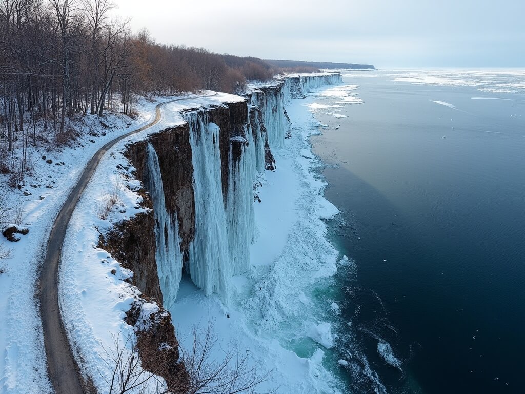
This above-cave hiking trail runs roughly 13 kilometres one-way along the cliffs overlooking the ice caves and water below. It doesn’t give you the experience of walking inside the formations, but it provides stunning views of the caves from above.
Option two: Red Cliff Ice Caves
Just south of Meyers Beach sits Red Cliff, home to an alternative ice cave formation. These caves form more reliably than the main Apostle Islands caves because of their specific geography and water flow.
Option three: Winter in Bayfield itself
If neither cave option is viable, pivot entirely. Bayfield becomes a destination for a completely different reason—as a charming small town with excellent restaurants, galleries, and local character.
Planning reality: Build your trip around the region, not the specific caves. If the caves open, magnificent. If they don’t, you’ve got genuine alternatives.
How to Actually Monitor Conditions (And Why Timing Is Everything)
This is where most people fail in planning their ice cave trip. They assume conditions either exist or don’t, and they’ll find out when they arrive.
Serious visitors obsessively monitor conditions starting in early January.
The monitoring strategy:
- Check the National Park Service website regularly for official updates
- Call the dedicated ice line phone number (updated daily during potential opening season)
- Follow local Bayfield area weather services and Facebook groups
- Watch long-range forecasts for extended cold snaps and wind patterns
- Join local ice cave enthusiast groups on social media
The people who successfully visit ice caves don’t plan trips three months in advance. They build flexibility into their winter schedules. They accept that most years they won’t visit at all.
The Physics of Why These Caves Are Disappearing (Climate Change Isn’t Theoretical Here)
Winter in northern Wisconsin is getting warmer. It’s not speculation; it’s measurable data. The caves need extended periods of unbroken cold. A few days of subzero temperatures followed by a warm spell causes rapid ice deterioration.
The climate data supports what locals observe:
- Average winter temperatures in Wisconsin have increased by roughly 2-3°F over the past 30 years
- The duration of sustained subzero periods has decreased
- Lake effect snow patterns have become less predictable
- Freeze-thaw cycles have become more common, destabilising ice formation
The takeaway: The opportunity to see these caves is real, but the window is narrowing.
Safety Protocol and What the Park Service Actually Does During Opening Season
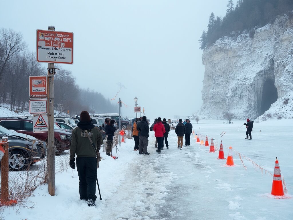
Park Service safety measures:
- Daily ice thickness testing at multiple locations
- Visual inspection of ice stability and crack patterns
- Weather monitoring for sudden temperature changes or wind events
- Restricted access hours (usually daylight only)
- Ranger presence at the trailhead
- Required safety briefing for all visitors
- Clear marking of safe routes and danger zones
- Maintained communication with emergency services
- Authority to close access immediately if conditions change
The survival math: Lake Superior stays roughly 40°F year-round. Cold-water immersion causes involuntary gasping and incapacitation within minutes. The Park Service protocols exist because they reduce death probability from “significant” to “nearly zero.”
What Local Businesses Actually Experience During Ice Cave Season
When the caves open, the regional economy notices immediately. Restaurants, hotels, and guides see a massive spike in demand. But it’s unpredictable. The boom-and-bust cycle stresses local business planning.
Supporting the region means understanding this seasonal reality and potentially timing visits to coincide with cave season possibility, even if the caves themselves don’t cooperate.
The Photography Obsession and Why These Caves Broke the Internet in 2014
In 2014, viral photos made the caves famous—but also harder to access. The attention changed visitor expectations and increased pressure on safety systems. Be realistic about what you’ll see.
Building a Multi-Day Wisconsin Winter Trip (Even Without Guaranteed Cave Access)
The three-day minimum structure:
- Day one: Arrive in Bayfield, explore town, check ice updates
- Day two: Attempt caves or hike above-cave trail
- Day three: Visit Red Cliff or enjoy local winter activities
Recommended internal links:
- Watch the Sunrise from Cadillac Mountain
- Explore White Sands National Park
- Hike to Delicate Arch in Arches National Park
- Take the Cog Railway to the Top of Pikes Peak
- Visit the National Civil Rights Museum in Memphis
Medical and Physical Considerations for Different Visitor Types
Important considerations: The caves require balance, cold-weather endurance, and physical capability. If you have mobility limitations or certain medical conditions, stick to the above-cave trail or Red Cliff caves.
The Indigenous and Cultural Context You Should Understand
This land belongs to the Ojibwe people. The Red Cliff Band continues to live here. Visit respectfully. Learn the history. Support Indigenous businesses.
Final Reality: Should You Actually Plan This Trip?
Visit if: You live nearby, have flexible scheduling, or appreciate winter adventure.
Don’t visit if: You need guarantees or singularly want “that one photo.”
What This Moment Actually Represents
These caves are a disappearing phenomenon. Understand the system. Watch the forecasts. Be flexible. Support the region. And when the moment aligns—go. Because there’s nothing else quite like it.