Image Credit @The Travel Chica
Mount Washington tops out at 6,288 feet, modest by mountain standards, until you learn it holds the record for the highest wind speed ever recorded on land at 231 miles per hour. Most people don’t realize it’s not the altitude that gets hikers into trouble up there, it’s the weather changing faster than anyone expects.
It’s the weather.
And the decisions people make when they’re tired, unprepared, and convinced they can push through.
I learned this the hard way during a poorly planned late-autumn hike five years ago.
I’d climbed plenty of peaks in the Lake District, so I figured Mount Washington would be straightforward.
Bring decent boots, some layers, go early, be back by evening.
Classic British overconfidence.
I made it three-quarters of the way up the Jewell Trail before the temperature dropped about fifteen degrees in twenty minutes.
The wind came out of nowhere—absolutely screaming through the ravines.
I couldn’t see more than ten metres ahead.
My phone had no signal, and I suddenly understood why the mountain earned its nickname: “Home of the World’s Worst Weather.”
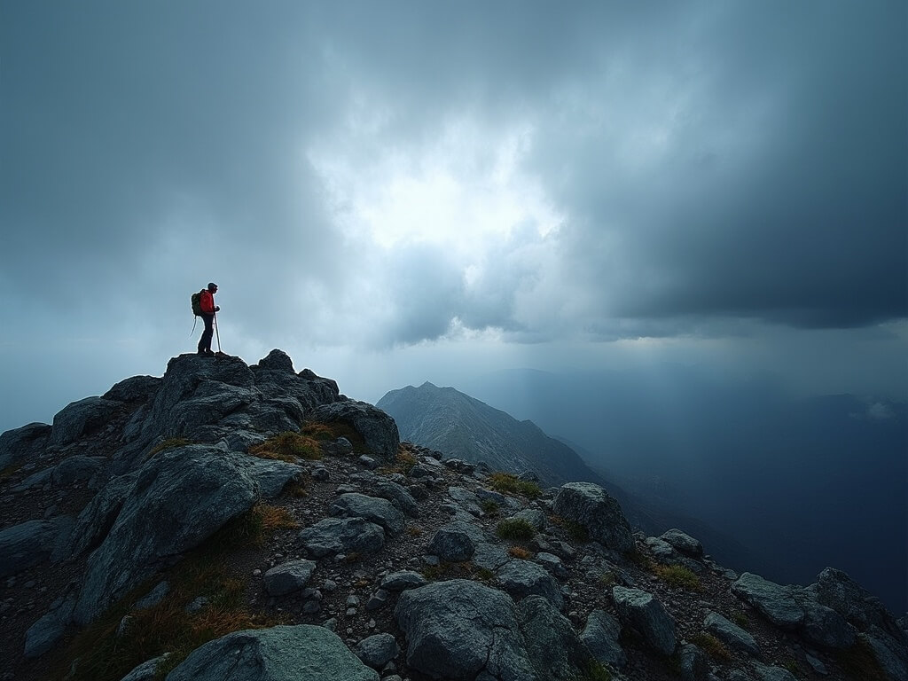
Image Credit @The Travel Chica
I turned back, shaken but fine.
That experience taught me something crucial: Mount Washington doesn’t care how fit you are or how many mountains you’ve climbed elsewhere.
It’s genuinely different, and understanding why matters before you commit to the summit.
What Makes Mount Washington So Extreme (And Why You Need to Know This Before You Start)
Mount Washington sits at the heart of the Presidential Range in the White Mountains.
It’s not just the highest peak in New Hampshire—it’s the highest in the entire Northeast.
But the numbers don’t tell the real story.
The mountain creates its own weather systems.
Three major storm tracks converge right where Mount Washington stands, like a bullseye for meteorological chaos.
Average annual snowfall at the summit: 281 inches.
That’s nearly 23 feet per year.
Wind speeds regularly exceed 100 miles per hour, even in summer.
The record of 231 mph was set in 1934 and still stands as the highest wind speed ever officially recorded on land anywhere on Earth.
Not Alaska, not Antarctica, not Everest.
Mount Washington.
Here’s what catches most people off-guard: the weather can turn in minutes, not hours.
You can start your morning hike in brilliant sunshine, warm enough for short sleeves, and find yourself in a whiteout by mid-afternoon.
Temperature drops of twenty to thirty degrees in less than an hour aren’t unusual.
The summit sits above the treeline, which means zero shelter once you’re high enough.
No trees to break the wind, no natural barriers.
Just exposed alpine terrain where conditions deteriorate faster than your ability to descend.
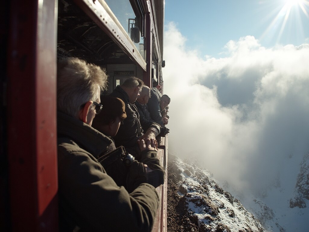
Image Credit @The Travel Chica
Add to this the fact that many hikers underestimate the physical demand.
The Jewell Trail, considered the “easiest” major route, still covers 9.6 miles round-trip with nearly 4,000 feet of elevation gain.
That’s not a stroll—that’s a serious undertaking.
And you’re doing most of it above treeline in unpredictable conditions.
The core reality: Mount Washington isn’t dangerous because it’s high. It’s dangerous because the weather is genuinely hostile, and people make poor decisions under stress and fatigue.
The Four Ways to Reach the Summit (And Which One Actually Makes Sense for You)
Here’s where Mount Washington becomes interesting.
Unlike most serious mountains, you have genuine options for reaching the summit.
Different approaches suit different people, different fitness levels, and different risk tolerances.
Let me break them down honestly.
Option 1: Hiking Routes—The Classic Challenge (Not for Everyone)
If you’re fit, experienced, and mentally prepared for genuine adversity, hiking offers the most authentic Mount Washington experience.
Multiple routes exist, each with different difficulty levels.
- The Jewell Trail: widest and “easiest” major hiking route, 9.6 miles round-trip, 3,900–4,275 ft elevation gain
- The Ammonoosuc Ravine Trail: steeper, rugged, scenic, connects to Lakes of the Clouds Hut
- The Tuckerman Ravine Trail: historic, steep, exposed, funnels wind and weather
- The Lion Head Trail: summer and winter variants, winter version avoids avalanche zones
- The Huntington Ravine Trail: technical, for experienced climbers only
What you actually need to know about hiking Mount Washington:
- Fitness alone isn’t enough—you need mountain experience, especially in bad weather
- Bring proper gear for conditions worse than the forecast predicts
- Navigation must be solid; people get lost in whiteouts
- Turn-back discipline is essential
- Late June through September is main season, but weather remains unpredictable
The hiking option is genuinely challenging and genuinely rewarding.
It’s also where most of the mountain’s rescue callouts originate.
Option 2: The Mount Washington Cog Railway—Maximum Access, Minimum Risk
The Cog Railway has been operating since 1869—155 years of moving people safely to the summit.
It’s the steepest rack railway in North America.
The round-trip takes about three hours, including one hour at the summit.
You sit in an open-air train car, climbing through multiple climate zones.
Advance tickets are essential during peak season.
Summit amenities include the Sherman Adams Visitor Center, the historic Tip Top House, and even a seasonal post office.
Pro tip: hikers can buy one-way descent tickets to descend by train.
The Cog Railway reality:
- Accessible to families, older people, and anyone of any fitness level
- Historic and charming experience
- Subject to weather-related closures
- Offers flexibility and safety
Option 3: The Mount Washington Auto Road—Flexibility Without the Hike
The 7.6-mile Mount Washington Auto Road offers a drive from Pinkham Notch to the summit.
Drive yourself or take a guided van tour—both offer unique perspectives of the mountain’s dramatic elevation and weather shifts.
Weather closures happen frequently with little notice.
The Auto Road is also the origin of the famous “This Car Climbed Mt. Washington” bumper sticker.
The Auto Road reality:
- Accessible summit option without hiking
- Flexible and fast (2–4 hours)
- Weather closures are common
- Offers a middle ground between challenge and safety
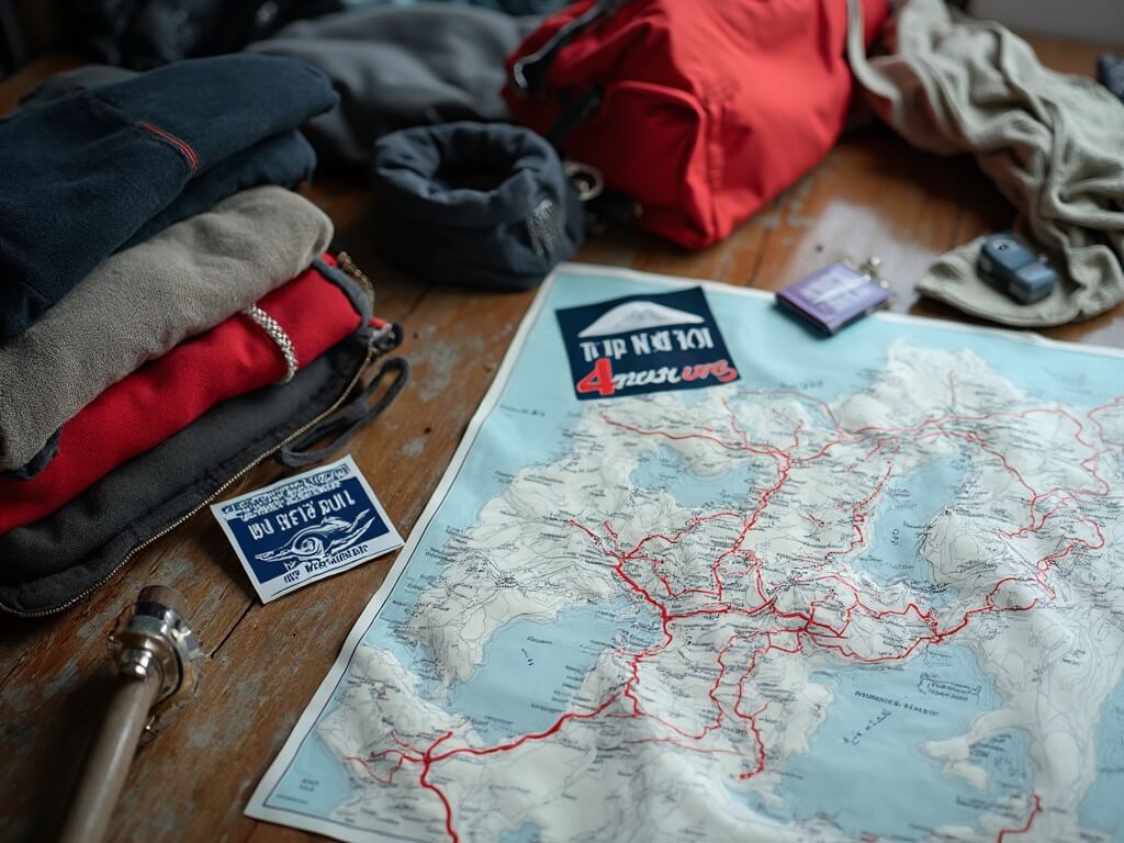
Image Credit @The Travel Chica
When Weather Turns Into a Genuine Emergency
Mount Washington doesn’t just have bad weather.
It has some of the harshest weather on Earth outside of polar regions and the highest peaks.
The record wind of 231 mph was measured in 1934 with instruments that would break today.
The summit weather station operates continuously, feeding data worldwide.
Weather at the summit can differ drastically from the base—hypothermia can occur quickly under wind chill and moisture.
Mount Washington’s rescue statistics:
- ~100 rescue callouts annually
- Hypothermia, exposure, falls, navigation errors are most common
- Fatalities happen—usually a few per year
- Most incidents are preventable
Essential Gear That Actually Keeps You Alive
This is a non-negotiable checklist for hikers:
- Multiple wool or synthetic layers
- Waterproof outer shell
- Warm hat & gloves even in summer
- Sturdy hiking boots with ankle support
- Map, compass, GPS (not just your phone)
- Sunscreen & sunglasses
- Headlamp or flashlight
- First aid kit
- High-calorie food & extra snacks
- Water or hydration system
- Emergency bivy sack or shelter
- Whistle
Redundancy is key—bring backups for critical items.
This isn’t paranoia—it’s competence.
The Window of Opportunity: When You Can Actually Summit Safely
Late June to early September: Main hiking season, best safety margins.
March to April: Prime for experienced winter climbers—stable snow conditions.
Autumn (Sept–Oct): Beautiful, but deteriorating weather and shrinking daylight.
Winter (Nov–Feb): For expert alpinists only; rescue nearly impossible in storms.
Summer does not mean safe—just more survivable.
Preparing Your Body and Your Mindset
Physical fitness matters—but not as much as mental preparedness.
Success on Mount Washington comes from:
- Experience with mountain weather
- Ability to focus under fatigue
- Willingness to turn back
- Realistic self-assessment
- Familiarity with altitude effects
Train with hill work and elevation gain, not just cardio.
Mental discipline is key—decide turnaround points before you climb.
The mountain will be there next year. Your life is non-negotiable.
Related Adventures You Might Like
Winter Climbing: When Mount Washington Becomes Genuinely Alpine
Here’s something most casual hikers don’t realise: Mount Washington in winter isn’t just the summer hike in cold conditions.
It’s a completely different mountain requiring completely different skills.
The terrain transforms. What’s a straightforward hiking trail in June becomes a technical alpine climb in January. Snow and ice cover the ground, reducing friction and increasing fall risk dramatically. Wind chill can reach minus 80 Fahrenheit. Visibility can drop to arm’s length. The mountain stops being a day-hike destination and becomes a serious mountaineering objective.
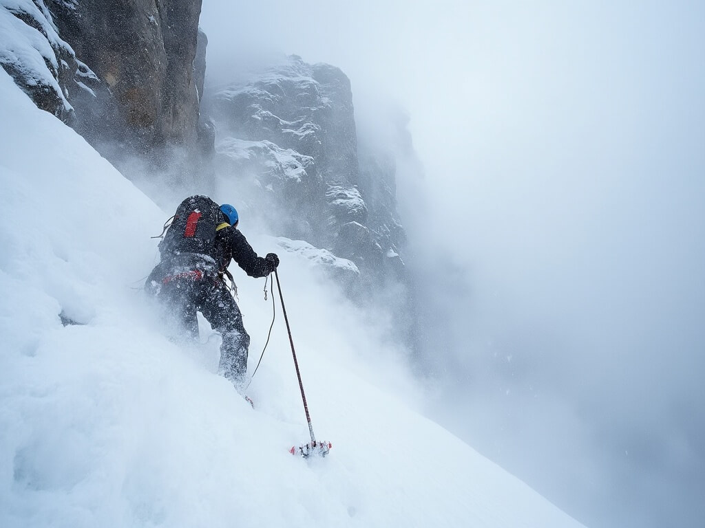
Image Credit @The Travel Chica
But here’s the thing that surprises people: winter climbing on Mount Washington is actually growing in popularity, and for specific climbers, it’s less about the difficulty and more about the access to genuine alpine climbing without traveling to Colorado or Alaska.
Winter mountaineering on Mount Washington teaches skills that transfer directly to bigger peaks. Learning to use crampons properly on the Lion Head Winter Route isn’t just a checkbox on your mountaineering resume—it’s foundational competence you’ll need on harder objectives later. The mountain becomes a training ground for serious climbers.
What changes about the mountain in winter:
- Technical equipment becomes non-negotiable: crampons, ice axe, helmet, avalanche beacon, rope, harness
- Navigation becomes significantly harder; many familiar summer landmarks disappear under snow
- Wind chill creates life-threatening cold within minutes of exposure
- Avalanche danger exists in specific gullies, particularly Huntington Ravine and the Tuckerman Ravine
- Daylight is severely limited; you need to be moving efficiently or you’ll descend in darkness
- Rescue becomes far more difficult; helicopter rescue is impossible in many winter conditions
The preferred winter routes are Lion Head (winter version specifically), Ammonoosuc Ravine, and, for very experienced climbers, Tuckerman or Huntington Ravines.
The Lion Head Winter Route specifically avoids the Lion Head summer trail’s avalanche terrain. Instead, it approaches from different angles, trading straightforward hiking for more technical snow and ice climbing but reducing avalanche exposure.
Most people attempting winter Mount Washington climbs do so in late February through early April when conditions stabilize somewhat and daylight extends enough to support a full day on the mountain.
I spoke with a professional mountain guide based in New Hampshire who winters regularly on Washington, and she emphasized something that stuck with me: “Winter climbing isn’t harder because it’s colder—it’s harder because you’re making decisions with incomplete information and your body is working against you constantly.”
Guided Experiences: When Professional Support Transforms a Risky Objective Into a Manageable One
Here’s an admission most climbers avoid: hiring a guide might be the smartest decision you make, not because it removes all risk but because it introduces competent decision-making into situations where fatigue and enthusiasm regularly override judgment.
Mount Washington has several guide services offering everything from day hikes to multi-day mountaineering courses. These aren’t expensive recreation add-ons; they’re insurance policies written in expertise.
A qualified guide brings:
- Real-time risk assessment based on decades of mountain experience
- Decision-making frameworks tested in actual emergencies
- Avalanche forecasting knowledge specific to Mount Washington’s gullies
- Technical instruction in crampon technique, ice axe use, and rope management
- Accountability—a guide’s professional reputation depends on your safety
Guided winter mountaineering courses typically run three to five days. They’re structured specifically for people with solid hiking experience but no winter mountaineering background.
Beyond winter climbing, guides offer value for summer hikers attempting routes like Huntington Ravine or planning Tuckerman Ravine ascents during spring ski season.
What Actually Happens When You Reach the Summit
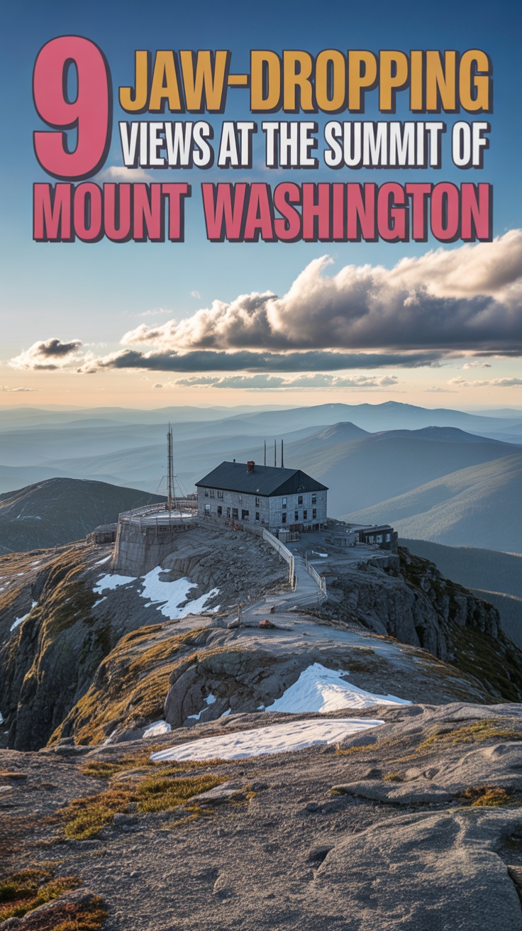
After hours of effort, you finally step onto the Mount Washington summit. What’s actually there?
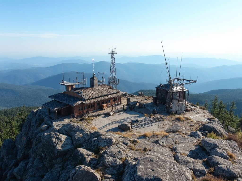
Image Credit @The Travel Chica
The summit is relatively flat and rocky—around fifty yards across. The Sherman Adams Visitor Center, the historic Tip Top House, a weather station, communication towers, and utility structures dominate the space.
The Visitor Center includes restrooms, a cafeteria, educational panels, a gift shop, and even a post office. The Tip Top House, built in 1853, is a small museum with historical displays.
On clear days, you can see 130 miles in every direction—the White Mountains, parts of Vermont and Maine, and sometimes even Canada.
On cloudy days, you’re inside the weather, which changes your understanding of the mountain’s hostility and character.
Most visitors spend 30 minutes to two hours at the summit. The smartest strategy: experience the summit, then descend.
The Descent: Where Most Mount Washington Mistakes Actually Happen
Most Mount Washington hiking accidents occur on the descent, not the ascent. Fatigue and overconfidence lead to poor decisions.
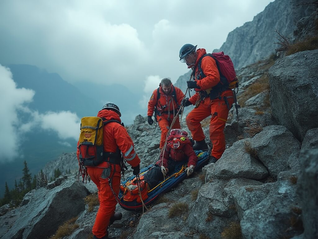
Image Credit @The Travel Chica
Descent discipline checklist:
- Slow down consciously
- Check footing carefully
- Stay hydrated and fed
- Monitor weather constantly
- Use trekking poles
- Watch for other hikers above
- Accept possible darkness; carry headlamps
- Rest if you’re moving recklessly
The Jewell Trail descent takes four to five hours—often underestimated. Fatigue, terrain, and weather all amplify risk on the way down.
Environmental Impact and the Ethics of Visiting Mount Washington
Mount Washington receives roughly 200,000 visitors annually. That high volume creates environmental stress, especially above the treeline.
Alpine vegetation is fragile. A trampled meadow can take 20–30 years to recover.
Leave No Trace principles apply with urgency here:
- Stay on trails, even if muddy
- Pack out all waste
- Respect wildlife and use designated facilities
Summit litter has become a visible problem. But education and organizations like the Appalachian Mountain Club are improving awareness and trail maintenance.
Rescue, Risk, and Reality
Mount Washington averages around 100 rescue operations annually. Most are minor: twisted ankles or fatigue.
Serious rescues involve falls, hypothermia, or weather emergencies. Fatalities range from 4–8 per year—low considering the number of visitors.
Most deaths result from a chain of poor decisions—not carrying gear, refusing to turn back, or going beyond skill levels.
The lesson: rescue should be the last resort, not a plan. Train and prepare to reduce risk from the start.
Practical Logistics: Making the Trip Happen Without Chaos
If you’re heading to Mount Washington, here’s how to make it smooth:
Driving and Access:
Most visitors route through North Conway, NH. The trailheads and Cog Railway are accessible within 1.5–2 hours from there.
If You’re Hiking:
- Start early—6:00 to 7:00 AM is common
- Arrive early to get parking
- Check trail and weather conditions on AMC or Observatory websites
Cog Railway or Auto Road:
- Book tickets in advance for peak travel
- Railway runs hourly; Auto Road runs continuously during open hours
- Costs range from $80–$120
Logistics Checklist:
- Book lodging for early start
- Bring cash and offline maps
- Tell someone your plan
- Carry a satellite communicator on serious hikes
Virtual Experiences and the Modern Alternative
Can’t make the trip? Mount Washington webcams and virtual reality tours offer immersive alternatives.
During the pandemic, webcams became popular for real-time summit weather. Today, VR tours help preview conditions or train for the real thing.
They’re not replacements for the summit—but they are tools for accessibility, planning, and appreciation.
The Question You Need to Answer Before You Start
You’re not just climbing a mountain. You’re entering an environment that demands preparation and respect.
Can you carry the right gear? Navigate in whiteouts? Recognize hypothermia? Turn back when necessary?
If you can say yes, prepare accordingly and go experience something genuinely remarkable.
If not, there’s no shame in taking the Cog Railway or Auto Road.
Mount Washington invites everyone—but rewards only the prepared.
Explore more:
That wind speed record is still the first thing I mention when anyone brings up climbing it casually. Climbing to the summit of Mount Washington in New Hampshire means respecting the weather more than the elevation number suggests you need to.